Drone & aerial services

Drone & Aerial Services Across Wigan & the North West

Professional aerial photography, video, visual inspections, surveying and documentation for properties, land, heritage, archaeology, woodland and projects across Wigan and the wider North West.

Based in Wigan · Working across Greater Manchester, Lancashire, Merseyside, Cheshire and the North West.

Flown responsibly
Quick, clear replies
Community Interest Company
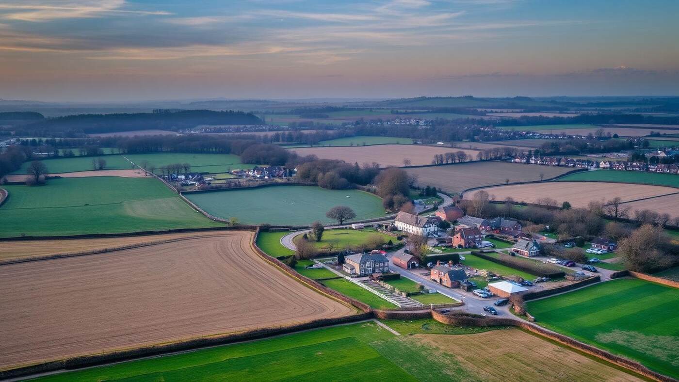
Aerial drone photograph of land near Wigan, Greater Manchester

What we do

Aerial work for property, land, heritage and projects

Roof Inspections & Visual Assessments

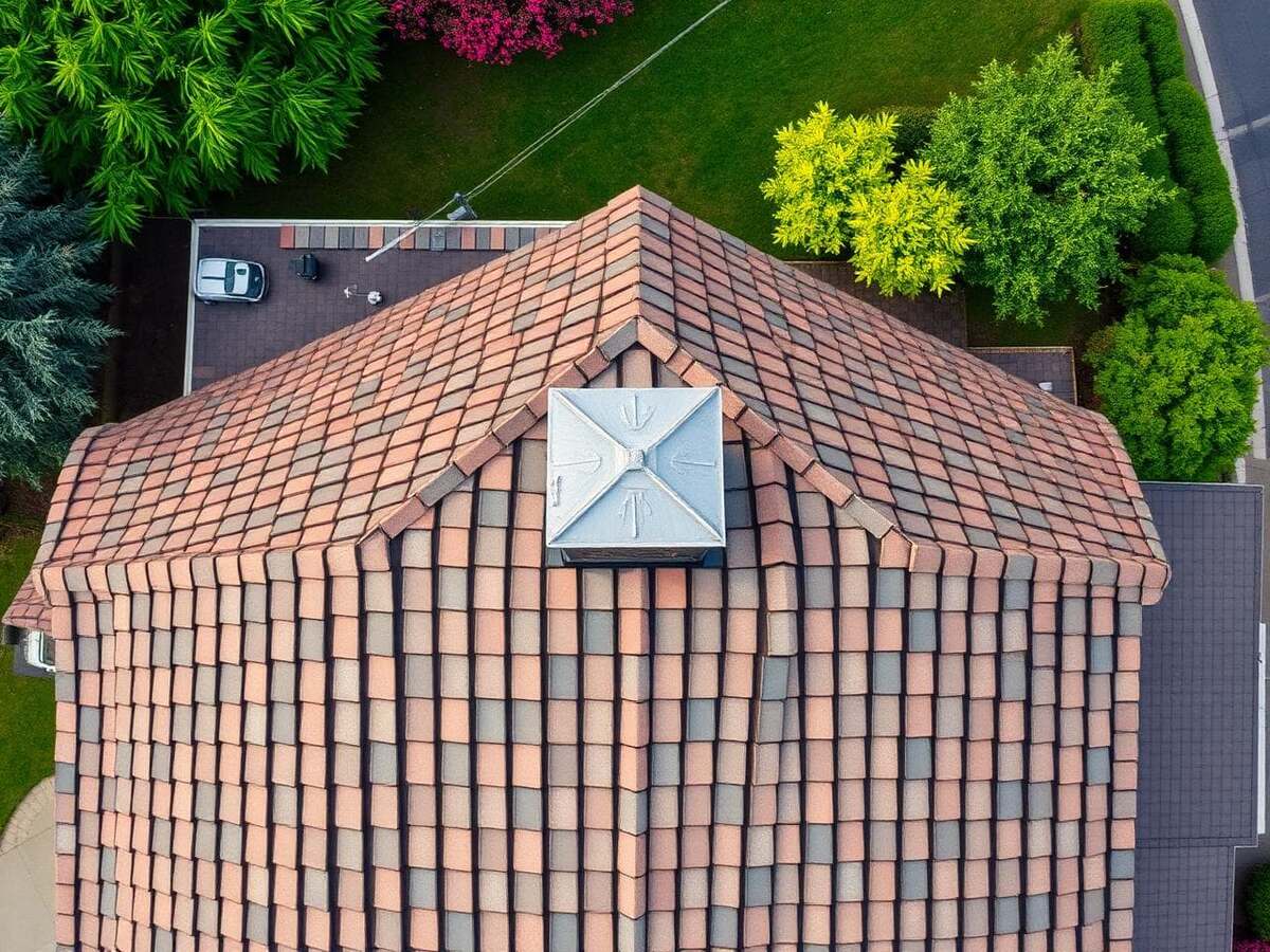
Aerial imagery giving a clear visual overview of roofs and other hard-to-reach areas — no scaffolding or cherry picker needed.

  • Roof condition checks
  • Identifying visible areas needing attention
  • Gutters and roofline imagery
  • Chimneys and hard-to-reach areas
  • Pre- and post-work documentation

These are visual aerial assessments. They do not replace specialist structural, engineering or professional inspections where those are required.
Aerial Photography

High-quality aerial photography of properties, businesses, land, buildings, landscapes, events, projects and community initiatives — perspectives that simply can't be captured from the ground.

  • Property & business imagery
  • Land and landscapes
  • Events and projects
  • Promotional material

Aerial Videography

Drone video made to look good, not just to prove we flew. Promotional campaigns, property marketing, heritage, construction, documentary and social content.

  • Promotional campaigns
  • Property marketing
  • Community & heritage projects
  • Social and digital content

Heritage Documentation

Aerial recording of historic buildings, monuments, industrial heritage and historic landscapes — creating a visual record that supports research, education, interpretation and future reference.

  • Historic buildings & monuments
  • Industrial heritage
  • Historic landscapes
  • Sites of local importance

Archaeology & Landscape Documentation

Aerial photography and documentation that can assist archaeological projects, landscape features, site records and ongoing project monitoring.

  • Site documentation
  • Historic landscapes
  • Research imagery
  • Project monitoring

Drone imagery supports archaeological work — it does not on its own constitute an authoritative archaeological assessment.

Woodland & Land Surveying

Aerial imagery and visual information across woodland, fields, estates, development sites and environmental projects, including monitoring change over time.

  • Woodland & fields
  • Estates and large land parcels
  • Environmental projects
  • Change over time

Aerial surveying here means visual survey imagery — not a certified, statutory or specialist professional survey.

Construction & Project Progress

Regular aerial imagery and video documenting construction progress, site overview, before-and-after conditions and project milestones.

  • Progress documentation
  • Development sites
  • Before and after
  • Project & promotional material

Need something different?

If your project doesn't fit the services above, get in touch. We'll talk it through and be honest about whether our drone services are suitable.

Discuss your project

Why Use Aerial Drone Imaging?

A drone gets a camera where a ladder, a scaffold or a pair of boots can't — quickly, safely and with a record you can keep.

Access difficult areas

Roofs, towers, steep land and awkward corners viewed safely from the air.

A different perspective

Context and scale you can't get from ground level or a street view.

Detailed documentation

High-resolution stills and video you can file, share and revisit.

Efficient coverage

Large sites and land covered quickly in a single visit.

Before-and-after records

Repeat flights to compare conditions across weeks, months or seasons.

Material that lands

Imagery strong enough for reports, websites, funding bids, socials and presentations.

Coverage

Based in Wigan. Working Across the North West.

We fly regularly around Wigan and travel out across the region for the right project. Anything further afield can be discussed — tell us where you are and we'll be straight with you about whether it works.

Wigan Greater Manchester Lancashire Merseyside Cheshire North West England
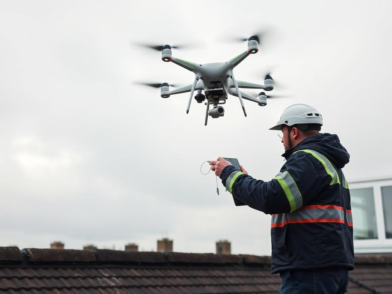
Drone pilot preparing an aerial inspection flight in Wigan, Greater Manchester

Who Can We Help?

Commercial clients, public organisations and individuals — the brief matters more than the badge.

HomeownersLandownersBusinessesProperty professionalsConstruction companiesHeritage organisationsArchaeological projectsCommunity groupsCharitiesLocal organisationsEvent organisersEstate & land managersDevelopersMarketing teamsIndividuals

Portfolio

Our aerial work

We only show our own imagery here. Categories still filling up are marked as coming soon rather than padded out with stock photography.

Aerial photography over land near Wigan
Aerial Photography
Drone view of a residential roof in Wigan
Property
Coming soon
Heritage
Drone pilot preparing a landscape flight in Greater Manchester
Landscape
Coming soon
Woodland
Coming soon
Construction
Coming soon
Community
Coming soon
Video
Community Interest Company

Your project can help support our wider community work

The Cross Network is a Community Interest Company based in Wigan. Income generated through commercial drone work contributes towards the sustainability and development of the organisation and its community-focused activities. You get the aerial imagery you came for — and the work does a bit of good on the way through.

More about what we do

Enquiry

Tell Us About Your Drone Project

Not sure exactly what you need? That's okay. Tell us about your project and we'll discuss the options with you.

  • • Every project considered individually
  • • Clear, honest answer on suitability
  • • Reply from a person, usually within a working day

Prefer email? info@thecrossnetwork.com

Have supporting images, plans or documents? Mention them here and we'll reply with a secure way to send them over.

How we work

Every project considered individually

  • Drone operations are subject to applicable aviation rules and airspace restrictions.
  • Locations and projects are assessed for operational suitability before we commit.
  • Weather and site conditions can affect when — and whether — we can fly.
  • Some specialist inspections or surveys need appropriately qualified professionals; we'll say so.
  • We're straight with you about what aerial imagery can and can't provide.

In short

Drone services in Wigan — the quick answer

The Cross Network CIC provides drone and aerial services across Wigan, Greater Manchester, Lancashire, Merseyside, Cheshire and the wider North West of England. Work includes aerial photography, aerial videography, roof and visual inspections, woodland and land aerial surveying, heritage and archaeological landscape documentation, and construction progress imagery. The Cross Network is a Wigan-based Community Interest Company, so income from commercial drone work supports its wider community activity.

Frequently asked questions

Do you offer drone services in Wigan?

Yes. The Cross Network is based in Wigan and works across Greater Manchester, Lancashire, Merseyside, Cheshire and the wider North West for aerial photography, video, visual inspections and documentation.

What does a drone roof inspection in Wigan involve?

We fly the property, capture high-resolution imagery of the roof, roofline, gutters and chimneys, and hand back clear visual documentation of what's visible. It's a visual aerial assessment, not a structural or engineering inspection.

Can you document heritage or archaeological sites from the air?

Yes. We produce aerial photography and video records of historic buildings, monuments, industrial heritage and historic landscapes to support research, interpretation and future reference.

How much does drone work cost?

Every project is priced individually — access, size, location, weather windows and deliverables all vary. Send us the details and we'll come back with a clear quote.

Do you cover areas outside the North West?

Often, yes — projects outside our immediate area can be discussed. Tell us the location and what you need and we'll be honest about whether we're the right fit.

Are you a commercial business or a community organisation?

Both, in a sense. The Cross Network is a Community Interest Company. We price commercial drone work fairly, and that income supports the sustainability and development of our wider community-focused work.

Have a project that could benefit from aerial imagery?

Whether you need a roof visually assessed, land documented, a heritage site recorded, stunning aerial photography or professional drone video, talk to The Cross Network about your requirements.

Based in Wigan | Serving the North West